 Cultural Landscape
Heritage from the Air with Bird's Eye Inc.
November 2019
Guest post by: Eldred Allen
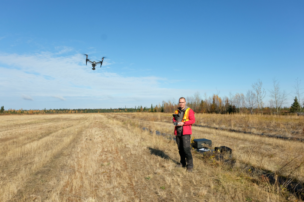
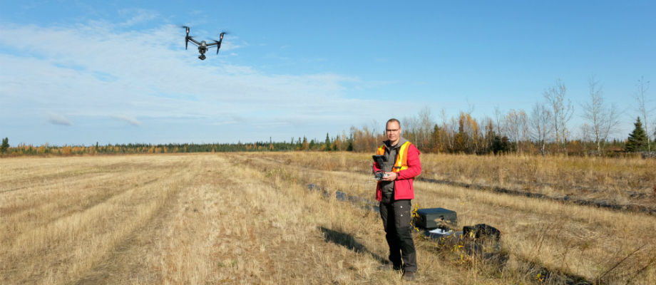
My name is Eldred Allen and I am the co-owner (with my wife, Kristy Sheppard) and full operator of Bird’s Eye Inc. in Rigolet, Labrador. Bird’s Eye Inc. is a Drone service provider that uses drone technology to provide a number of services, such as: collecting digital aerial photographs; videography; generating 3D models and orthomosaic imagery; inspecting and monitoring research sites; and monitoring sites over time. Recently, we worked with Tradition & Transition to collect digital data and imagery for a few of their community-based projects in Nunatsiavut.
Bird’s Eye Inc. has been operating for roughly 2 years and it really developed as a company by happenstance. Before we opened that company, I worked with the Nunatsiavut Government as a Geographical Information Systems (GIS) Specialist, which largely focused on digital and data mapping. GIS is a sophisticated geospatial tool that allows users to collect, manage, integrate, analysis, and display large quantities of geo-referenced or spatial data. I had been interested in drones for a while and purchased my first in 2016 for personal photography and fun. Because of my GIS background, I quickly recognized that drones were also a powerful digital data collection tool; it is so much more than just a camera, you can collect images and use a photogrammetry software to stitch them together to generate 3D maps or you can bring the images and data into a GIS and run computational analysis to produce additional data (like elevation, etc.). Drones are particularly useful in northern remote locations where most of our mapping data relies on either older, outdated data with fairly low resolution provided by Google Earth or the Government, or expensive, more up-to-date high resolution data from digital service providers with access to satellite imagery. Drones increase safety, lower project costs, and are a quick deployment data collection option that captures high resolution data which can be processed to deliver sophisticated data products. So we started the company and began taking on local contracts, although it did take a bit for our clients to realize how useful drones can be beyond an excellent aerial photography tool. Once we completed a few contracts and got a bit more exposure, industry, researchers, and the general public in our area became more knowledgeable about the versatility of using drones and started to ask for data collection, monitoring, and site development services – now we travel up and down the coast providing drone services all over Labrador. Labrador is fairly remote, and there is not much imagery out there from a drone or aerial perspective, so part of our work has focused on stockpiling imagery from each community. We also just added still photography (handheld, terrestrial photography) to our suite of services, which is exciting. I recently captured an image of a Minke whale out by the dock in Rigolet and Reuters News Agency based in London, UK, got in contact wanting to purchase use rights for their international database. That was great, it showcased the area, the wildlife, and our way of life here in Rigolet.
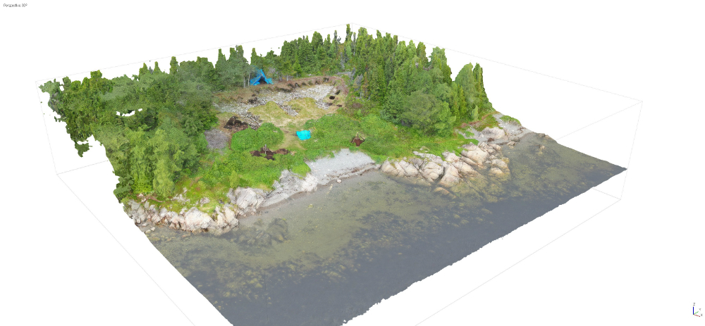
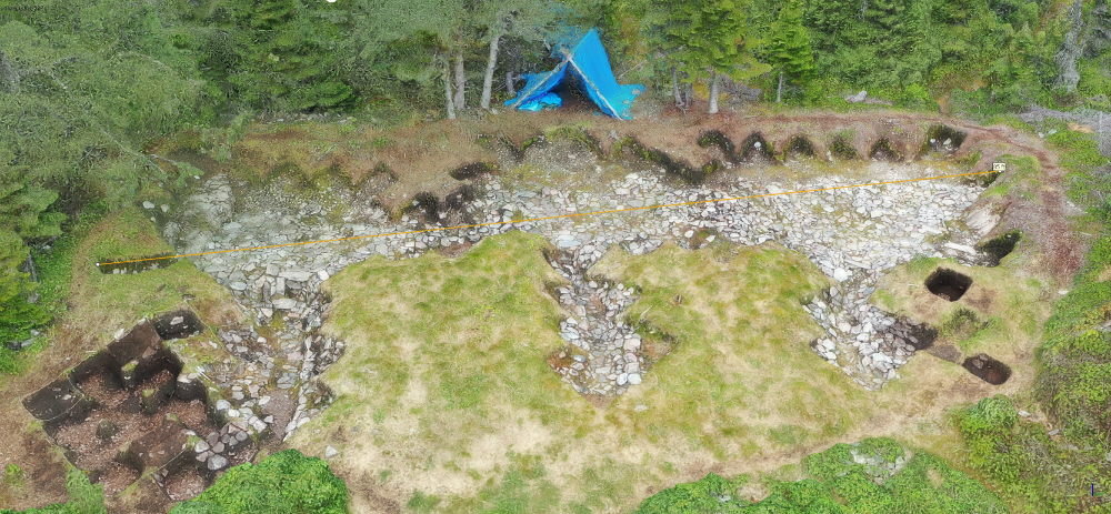
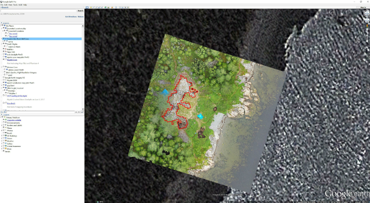
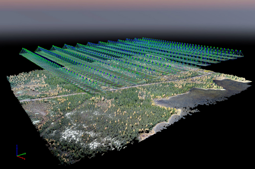
This is one of the reasons why we were excited to work with Tradition & Transition, because it allowed us to use our skills and services to support on-going collaborative research in our communities. We worked with Dr. Lisa Rankin on the Double Mer Archaeology project in Rigolet and photographed the on-going excavation of the late 18th century Labrador Inuit winter site located at the end of the board walk. We were able to produce a 3D model of the excavation from the drone imagery we collected, and this allowed her to ask a number of questions about the data (such as precise locations of various architectural features in relation to others or the absolute depth of various features on site) as well as to upload the 3D model that we produced into Google Earth (as a KML file). This is another great feature of drone imagery; the 3D models we produce allow us to provide a high tech service/imagery that can be stored with a relatively low tech software, like a PDF or a KML file, which can be manipulated by our clients without substantial knowledge of the high tech systems used to generate them. Our aerial imagery was also featured in a short video produced by the Office of Public Engagement at Memorial University. It promotes the collaborative research at Double Mer, the long history of the Rigolet community, the Net Loft that serves as both a community hub and field laboratory in the summer, and the boardwalk in Rigolet (which is the longest boardwalk in North America). Because we are based in Rigolet, it and the surrounding area is particularly well photographed year-round, so our images and video were ideally suited for this particular project.
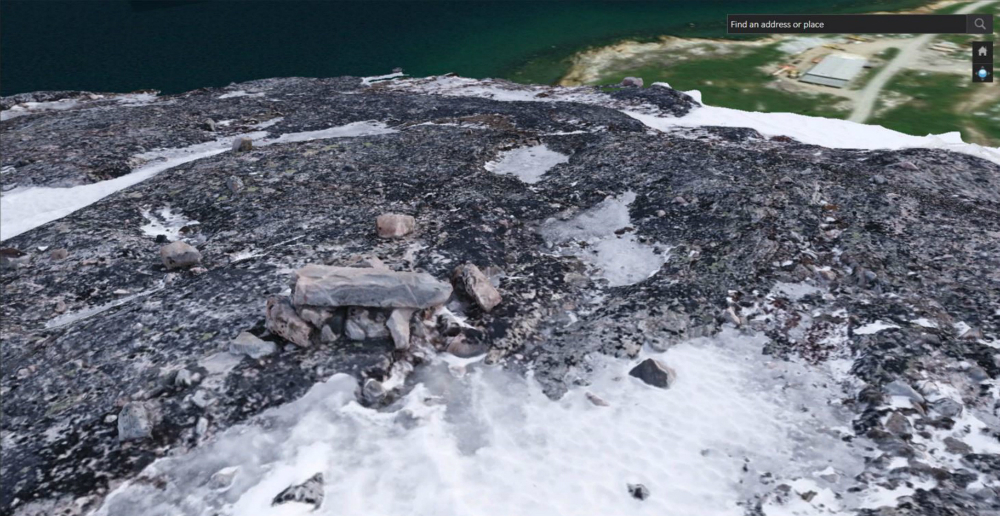
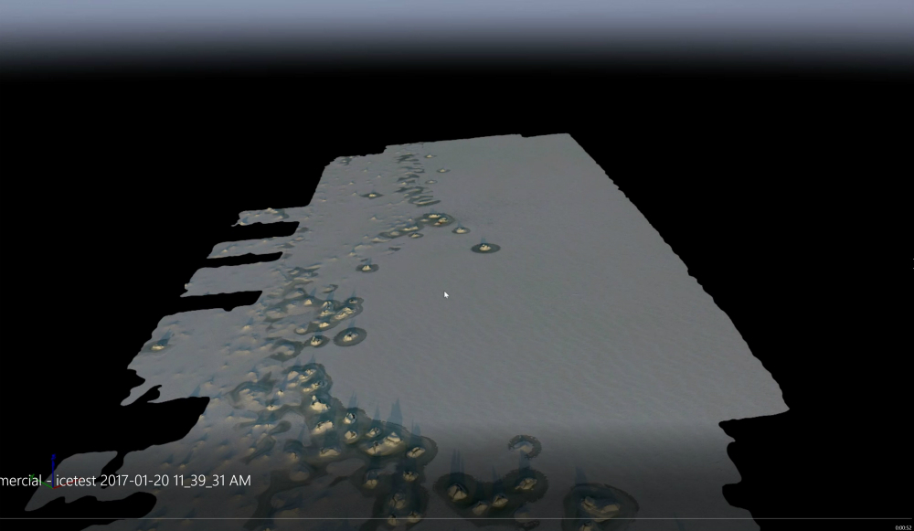
Birds Eye Inc. has also provided support for Tradition & Transition graduate student research. Sarah Wilson, a graduate student with Memorial University’s archaeology department, is studying how Inuit in Nunatsiavut used Inuksuit for travel and one of her main research focuses is on whether these structures are visible on the land during the winter. Bird’s Eye went out with fellow Tradition & Transition graduate student and drone operator, Deidre Elliott, to capture imagery of various Inuksuit around Hopedale, as well as winter landscape imagery, in March of this year. It was very challenging to collect these data; drones operate on lithium batteries which have to be kept at a certain temperature for them to be useable. It was -25 with the wind, so we had to keep the batteries and the drone warm by keeping the drone covered and the batteries close to our body heat. In the end, the cold had more of an impact on the people then on the equipment, and we were able to capture the imagery/data we wanted so it was a success. From this imagery, we were able to produce 3D models of the Inuksuit, as well as landscape overview shots, and imagery of Inuksuit in their landscape context. Building and operating Bird’s Eye Inc. thus far has been an interesting adventure. There are limited employment opportunities in rural contexts, so being able to work in an industry that is constantly developing at such a fast pace and that also focuses on interesting work has been an excellent opportunity for us. It is important to us that our work has a positive benefit for the communities; we are able to really show the beauty of our communities, our culture, and the people that live here, which is a great tourist benefit and as well as global exposure for our home.
Bird’s Eye Inc.’s aerial imagery was featured in the recently released “Becoming Labrador” documentary. Eldred Allen’s photography has also been selected for two art exhibits. Two of his photographs will be featured in the upcoming exhibition, “Nunatsiavut: Our Beautiful Land” at La Guilde canadienne des métiers d’art in Montreal on October 12th, 2019. His work will also be featured in chapter 3 of the online photography exhibition “A Maze of Collapsing Lines” by Toronto based Gallery 44, in partnership with the Inuit Art Foundation, in October 2019. For more updates, check out Bird’s Eye Inc. Facebook page.